A Scenic Hike on the Ray Roberts Lake Greenbelt Trail

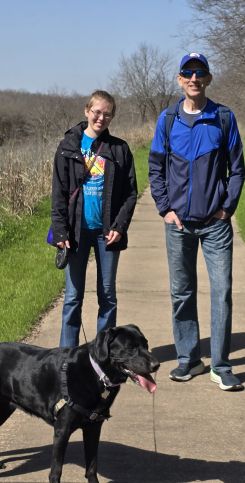
This past Saturday was a beautiful, sunny day with temperatures in the upper sixties—perfect for a hike. My husband, our daughter, and I, along with our dog, Roxie, decided to explore the Ray Roberts Lake Greenbelt Trail. While we had previously hiked the trail from the south in Aubrey,TX, we had never made it all the way to the trailhead at the Ray Roberts Lake Dam.
We began our adventure with a 40-minute drive from our home north of Dallas to the Ray Roberts Lake Greenbelt Trailhead. It is located on the south side of the dam. Upon arrival, we found two options for starting our hike. We chose the trailhead closest to the spillway at the dam.
It was late morning when we set out on a cement path near the rest area by the dam. The path quickly veered left, leading us southwest along the east side of the Trinity River. About a mile into the hike, we reached the other rest area and a walking bridge. The bridge took us across the river to the Bluebird Trail on the west side.
Bluebird Trail
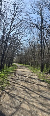
The Bluebird Trail was primarily gravel and well-maintained. After crossing the bridge, the trail turned south, winding through a dense wooded area. Though the trees were bare at this time of year, they formed a canopy that enclosed the path obscuring our view of the river.
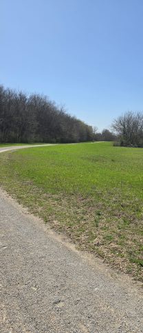
After about a mile, the trail opened up to a more expansive area. To our left, dense trees concealed the river that paralleled our path. Meanwhile, to our right, a field of vibrant green grass stretched toward farm fields in the distance. The trail twisted and turned, offering occasional glimpses of the river.
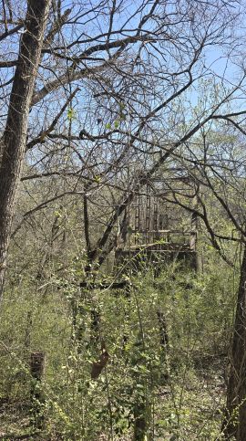
The Old McKinney Road Bridge
Further along, we encountered a dirt path leading to an old truss bridge in disrepair. The Old McKinney Road Bridge once connected two now-extinct communities but had been abandoned since the 1960s.
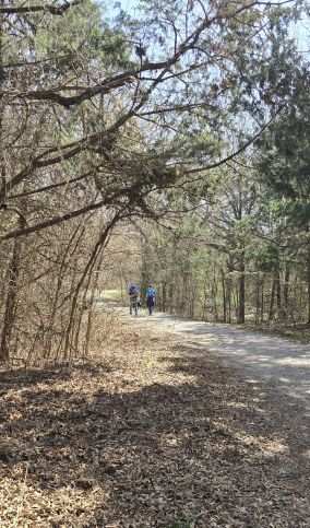
Continuing south for a few more miles, we occasionally encountered fellow hikers and cyclists. Roxie behaved well throughout the journey. Around the three-mile mark, we decided to turn back to keep our total distance to about six miles.
Retracing our steps on the Ray Roberts Lake Greenbelt Trail
As we retraced our steps, the afternoon sun had brought more people to the trail. Shortly after passing the old bridge, we found a bench nestled among the trees. We paused for a light lunch while Roxie drank some water.
Resuming our hike northward, we relished the warm air, sunshine, and peaceful surroundings. In the wooded section, a butterfly briefly followed us, fluttering so close that we thought it might land on Izzy. However, it flitted away before we could capture a picture.
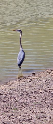
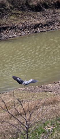
As we crossed the bridge back onto the east side of the river, a large egret soared overhead before gracefully landing at the water’s edge. It was a beautiful reminder of nature’s wonders.
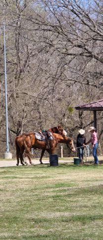
At the second rest area, we arrived just as a group of 15 to 20 horseback riders emerged. They came from the horse trail running south along the river’s east side. As I admired the horses from afar, my husband set up his drone to capture aerial views of the river and trail.
After taking a short break to enjoy the drone’s footage, we completed the final stretch of our hike and returned to our car. We were ready to head home.
Our hike along the Ray Roberts Lake Greenbelt Trail was a delightful experience, full of serene beauty and the excitement of exploration. The combination of river views, dense woodlands, and open fields made for a memorable adventure. We look forward to returning to explore more of this wonderful trail in the future.